
Click photo for printable map of Ananda Village.
Ananda Village is located 90 minutes north of Sacramento, California
and two hours southwest of Reno, Nevada.
Our Address: 14618 Tyler Foote Rd., Nevada City, CA 95959
and two hours southwest of Reno, Nevada.
Our Address: 14618 Tyler Foote Rd., Nevada City, CA 95959

- Take I-80 (E) towards Reno — go about 25 miles.
- At Auburn, turn left on CA-49 (N) toward Grass Valley / Nevada City — go 38 miles.
- Just past Nevada City, turn left at the “49 to Downieville” sign. Follow this road for 10.5 miles (watch your odometer). It’s a curving mountain road that crosses the Yuba River.
- Turn right on Tyler-Foote Road (immediately after the sign for Malakoff Diggins State Park) — go about 5 miles.
- Turn left (at the entrance of Ananda Village) onto Ananda Way.
- Drive a short distance on Ananda Way until you get to the “T” intersection, where Ananda Way meets Brotherhood Way.
- At the “T,” you will see a sign directing you to other areas of the Village.
- Turn right to go to:
- Banyan House for Living Wisdom Yoga Family Camp
- The Village Reception Office & Community Center
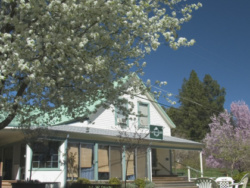
- Master’s Market and Deli
- Jewel in the Lotus Thrift Store
- Turn left to go to:
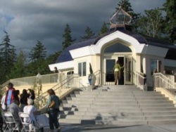
- For directions to Sunday Service at The Expanding Light Retreat, click here
- For directions to The Expanding Light Guest Retreat, click here
- For directions to the Ananda Meditation Retreat, click here

- Take I-80 (W) towards Sacramento — go 55 miles
- Take CA-20 (W) — go 27 miles
- Turn right on CA-49 (N) towards Downieville — go 10.5 miles
- Turn right on Tyler-Foote Road (immediately after the sign for Malakoff Diggins State Park) — go about 5 miles
- Turn left (at the entrance of Ananda Village) onto Ananda Way
- Drive a short distance on Ananda Way until you get to the “T” intersection, where Ananda Way meets Brotherhood Way.
- At the “T,” you will see a sign directing you to other areas of the Village.
- Turn right to go to:
- Turn left to go to: